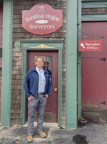
When to trust a stone wall: Boothbay surveyor Nicholas Plumer shares craft for National Surveyors Week
As Nicholas Plumer watched the SpaceX Starship rocket launch March 14, his mind drifted towards the future. “You know, we'll be surveying the planet Mars,” he said. “The new technology, it's going to Mars. Someone's going to have to go and map it all.”
Plumer owns Boothbay Region Surveyors in Boothbay, formerly Leighton & Associates. He bought the business from his former boss in 2017, and has been working in Maine since 2012. Because March 17-23 is National Surveyors Week, the Register caught up with the surveyor to learn about his profession and its significance for those a little closer than Mars.
According to Plumer, surveying in Maine is more tied to the past than future. That makes sense when the best boundary markers are rusting barbed wire fences, trees marked with old lead paint and, of course, stone walls.
“We're trying to record things for all time because the lineage, the history of a region doesn't change. It's pretty set in stone. Literally. It's stone walls and barbed wire fence,” he said. He later added, “You know to trust a stone wall as long as both owners don't own dozers because it's pretty hard to move a stone wall.”
However, fences rust, posts can be moved and age takes its toll, especially over punishing New England seasons. Add hundreds of years of property transfers dating back to George Washington, king's grants and early European settlements, and it’s not hard to imagine a surveyor must also be a historian. Plumer and his team often have to delve into historical records to tease out the land’s story. “It's my role to make sure the historical record gets crafted per the deeds, per the legal conveyance of the land,” he said.
According to David Tonry, who works at the company, the trick is finding out when the property was first divided. When land gets split, there should be a detailed document with clear markers explaining the process. He said the description of the land may change after that, so surveyors must find the original description. They can then unravel the order of how it was changed, tracing ownership backwards, forwards, or from both ends to find common links that tell the story.
Maine’s long history isn't the only challenge, and technology is a powerful solution. With thousands of miles of coastline along complex inlets, Plumer said water frontage makes the state unique. To capture the details of both the shore and inland, Plumer uses high-tech tools including GPS with sub-centimeter precision and drones that can help create 3D images from photographs or models with lasers.
However, sea levels are rising and landscapes change. “Oftentimes, deeds are written to the center line of a stream, and that stream changes. Boundaries are often along rivers and streams and even roadways, roadways change over time,” Plumer said.
Plumer said land area is measured from the mean high waterline towards the upland, and the upland moves. For example, he said whole subdivisions around Phippsburg are being eroded away, and some lots are completely gone. Locally, he noted Ocean Point, where roads have been washed out and houses were undermined. He said a road which may have been used as a reference may not get paved back the way it was.
He said surveyors need to use all the evidence available to maintain the boundary records, tapping into the technology or pulling records of everything available. “We're like mall cops: observe and report. You know, It's kind of silly, but we really are just tasked with documenting evidence on the face of the Earth,” he said.
But why go to all the trouble? According to Plumer, surveyors must ultimately be accountable for their work in court. He said one of the biggest misconceptions around surveying is that a single surveyed line or mortgage inspection sketch will suffice; it may not hold up to legal problems.
“That's not a survey, that's a very cost-effective means of telling the bank that there appears to be no visible problems,” he said. He approaches each of his jobs as potentially going to court, where he needs all of the research in hand to mark each property boundary and contested point.
Plumber said the issues don’t often go to court, and he has never had to. In fact, he said surveyors may only have to go once or twice in a career, but they have a unique role if they do. He said they can give their opinions, which lawyers can’t. “They are fighting for their client, I'm fighting for the line for the historical evidence,” he said.


